April 21st 6:00 PM start, about 45 degrees The Maple Highland Trail.
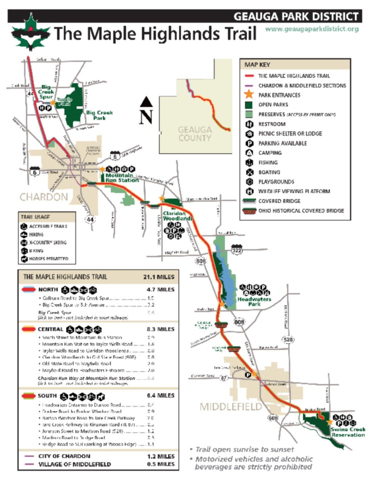
The MHT transitions at its northern trailhead off Colburn Road from the southern terminus of the Greenway Corridor trail. (Lake-Geauga Co Line just east of St. Rt. 44) The Greenway Corridor runs North-South from Painesville (Lake Co.) and connects to the MHT at the Lake-Geauga Co line. For most local riders, it is a seamless transition from trail to trail. The MHT is divided into 3 sections; the northern section running from Colburn Rd south to the north side of Chardon (4.7 miles). This section has a few modest turns and is slightly uphill going south as you ride away from Lake Erie toward Chardon. The trail end on the north side of Chardon’s business district. A 1/2 mile climb up to the town square, take a right down the hill and you catch the trail head to the central section. A little more than a mile between the 2 trailheads thru Chardon.


The central section is very scenic, with 3 covered bridges, one crossing over the Cuyahoga River. It is relatively flat with some easy turns and crossing over roads about every 2 miles. On this section you will see a new/nearly completed mountain bike course run by the Geauga Park district. This central section ends after 8.3 miles of riding at Headwaters State park north of Middlefield.


Crossing over RT 608 begins the newly paved southern section of the Maple Highlands Trail. Previous, a buggy trail for the local Amish community, it begins by working its way thru the old Grandview Golf course, then fades into the woods and farm lands. This section will take you into he north side of the town of Middlefield. To complete the entire trail, there is an unpaved section about 2.8 miles (buggy trails and gravel) that will take you to the southern terminus at Swine Creek Reservation Park. I was short on daylight, so had to drop the hammer and head for home. Slight downhill grade going north towards Lake Erie.


The paved section of the Maple Highlands Trail, including the of trail sections thru Chardon’s streets, encompass 21 miles. The trails are well maintained and offer many changes of scenery. There are relief stations along the trails and access to water in Chardon, Middlefield and Headwaters Park. I feel fortunate to have such close access to such a gem.
Including my distance to and from the trailhead to home, today was my 1st 1/2 century of the year 🙂 The forecast is starting to look more like spring in the coming weeks, so please be sure to check back for more more BikeOhio1000 trips.
