May 1st and what a beautiful day (Finally). 65 degrees at 9:30 with a forecast of mid-80’s. Today’s test, the Ohio & Erie Towpath Trail. To me, this is one of the gems of Ohio’s trail system. The Towpath Trail’s northern terminus is Cleveland and the southern in Bolivar nearly 85 miles with Akron a natural midpoint. The surfaces will transition from paved to compressed crushed limestone. I have seen road bikes on the flat limestone but today I will be rolling on my Fuji Jari gravel bike. In regards to logistics, I parked at the Rockside Station which is 10-11 miles south of the northern-most trailhead. Speaking of Rockside Station, another cool feature of the trail is the Cuyahoga Valley Scenic Railroad. The railroad runs from Cleveland to Akron and offers “bike and ride” tickets allowing cyclist to ride the train one way, and bike back.
I started out by heading north, I had never completed this section on prior rides so a first for me. This section of the trail runs thru Cleveland’s industrial backbone area, thru the railyards and steelyards, then winds slightly uphill to the Tremont area of Cleveland. At this point the trail reverts to the street so I made the decision that I would turn and begin my ride south.


My goal today was 75-100 miles; was going to see what happens, sunny day, why not! From Tremont to Rockside station, there is a small section where you need to ride on the road, but beside that, you can ride to Akron 30 plus miles on trail alone.
At Rockside(Thornburg) Station the trail transitions to crushed limestone. You now have the Ohio & Erie Canal on your left, and the Cuyahoga River on your right. You are now in the Cuyahoga Valley National Park. It is such a pretty and relaxing ride, with the water, the old canal locks, and the canopy of trees above.


Just past “Red Lock” I arrived in Boston Mills. I stopped in the roadside store to grab a water and a Gatorade. I crossed the road to head down the trail only to find that several bridges had been washed out and the trail was closed. I backtracked a few miles, then took to the road for 3-4 miles assuming I could by-bass the trail issues and hop back on at the Peninsula trailhead.


At lock 39 in Pennisula I started south again, only to find another “trail closed” sign less than a mile down the trail. 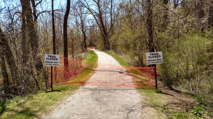
Frustrated, I thought about heading back, but instead I mapped a route on the road that would take me to the southern end of the park, riding along Riverview Rd for 5-6 miles. I was able to re-connect to the trail off Ira Rd. which is basically where the trail transitions to the Summit Metro Parks. 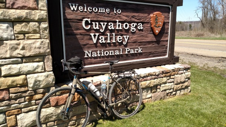
Just past Botzum Station the trail crosses Riverview and goes back-and-forth between asphalt and limestone. I rode past “Big Bend” and just past the 35 miles marker at Memorial Park. Here the trail is again under construction. I was ready to turn for home.


I would not hesitate to recommend this ride to anyone. The views never get old and the trails away well maintained. With my by-pass miles, my total trip was 78 miles today.
