Back on May 1st, I documented my O & E Towpath ride from Cleveland to Akron. I have covered that section many times as it is favorite. Today I set out to cover the southern section of the trail, running from Akron south to Bolivar in northern Tuscarawas County. I had made it to the Memorial Parkway trail head on the north side of Akron my last trip, which was where the trail construction requires a detour. I jumped ahead south today and made the “Lock 3 Park” in downtown Akron my starting point.


It took a while to get the parking situation squared away. Once I was off, I found the first several miles very fragmented. The trail is well marked but several construction areas lead to lots of stops-starts, detours, and even walking a short distance. Getting out of Akron takes me to on road-side bike lanes at some points.
The Summit Co section of the Towpath is primarily paved but sections thru Barberton were more crushed limestone, along with many bridges and even a long boardwalk crossing at Summit Lake.
I finally settled into my rhythm around Barberton and it was a comfortable cruise along the water as I roll to the Clinton trail head about 16 miles into the ride.


Just south of Clinton I see the last mile marker in Summit Co, mile 53. Just after that, I enter Stark County.


Just between mile 1 & 2 of Stark Co. the trail goes from asphalt to crushed limestone. Shortly after that, I roll into Canal Fulton. Cool little town right on the canal.


I spot an ice cream stand ( i will hit that one the way back).
Photo opt at Lock 4.


As I continue, you can really see how swollen the Tascarawas River is from the recent rains. At times it is only a few feet below the towpath surface. Rolling along, canal on my left, river on my right and sometimes less than 20 feet separating the two.
The trail begins to open up as I approach then enter Massillon. The canal disappears as I ride between the river and what I believe is RT 21.


There is a short off trail section at Tremont Ave/5th St., crossing the Memorial bridge, which is also the trail head to the Sippo Valley Trail.


I come across this architectural gem; the oldest Iron Bridge in Ohio! How about that! I do enjoy finding historical points of interest.


Another 3 miles down the trail I come across this cool monument to John Glenn.


This section of the trail is a bit rougher, as I encountered several downed trees and many other large branches on the trail. With the canal back on my left and the swollen Tuscarawas on my right, and more mud and grit on the trail, I had visions of my 2017 ride on the Chesapeake & Ohio ride from DC to Cumberland, MD. I pass thru Navarre.


Right around the 23 mile marker, just north of McDonnell at Canal Bend my rear tire goes down.


Hard to believe that I have covered more that 3,500 this year and this is my first flat. I make a quick tube change. The temperature has dropped and there is now a light drizzle. I am only about a mile from the end of the Stark Co. section so I decide to make the turn north. 43 miles.
On my way back, I stop in Canal Fulton for my double-dip cherry cone.

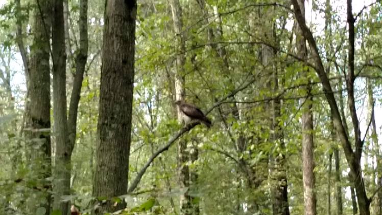
I also spotted this hawk (red-tailed, not positive).
The sun comes back out, but have a mild headwind as I backtrack thru Clinton, then Barberton and back into Akron. I really enjoyed the day. If I had to change anything, I would have just started at Summit Lake. 85 miles in the day. 975 of Ohio Trails for 2018.
Thanks again for following BikeOhio1000.
